|
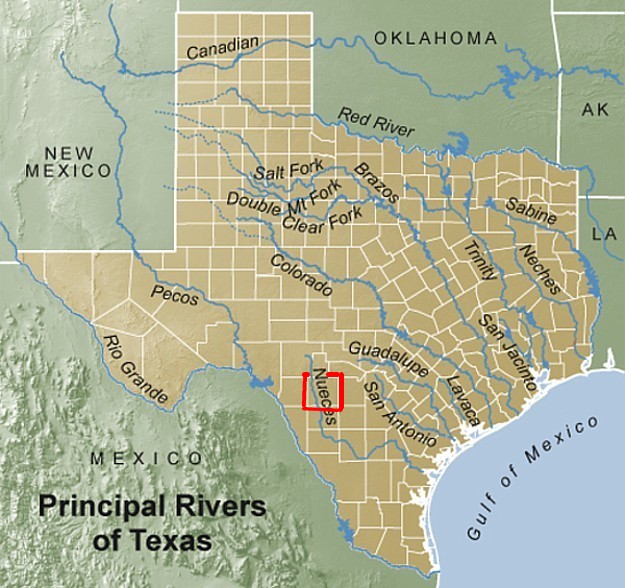
Map 8 (Below): Rivers of Texas. Four rivers are found
within Uvalde County. Two branches of the Nueces River (in west Uvalde Co.) and two branches of the Frio (in east Uvalde
Co.). All four rivers are part of the Neuces watershed. The boundaries of Uvalde Co. are outlined in red.
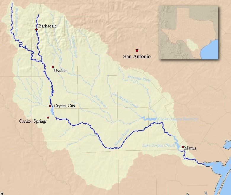
Map 9 (Below): Nueces River Watershed.
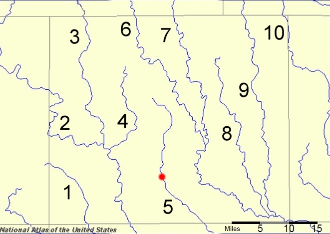
Map 10 (Below): Closeup - Rivers & Creeks of Uvalde Co.,
Texas. The approximate location of the City of Uvalde is indicated by the red dot.
1 – Turkey Creek,
2 – West Nueces River, 3 – Neuces River, 4 – Indian Creek, 5 – Leona River, 6 – Dry Frio River,
7 – Frio River, 8 - Blanco Creek, 9 – Sabinal River, 10 – Seco Creek.
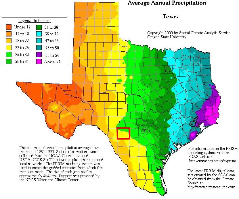
Map 11 (Below): Average Annual Rainfall in Texas. Uvalde
County receives 22 - 30 inches of precipitation during an average year. The boundaries of Uvalde County are highlighted
in red.
Map 12 (Below): Major Aquifers of Texas. At least
five different aquifers are found beneath Uvalde County. The boundaries of Uvalde Co. are highlighted in red.
Texas Aquifers
The state of Texas covers 23 aquifers (7 major and 16 minor aquifers) that underlie approximately ¾
of the state. The Ogallala Aquifer accounts for about 90% of the water in all of Texas aquifers. Groundwater
from Texas aquifers is used for irrigation, municipal use, manufacturing, and livestock production.
Pumping of water from many aquifers in Texas has resulted in a significant lowering of the water table.
Source: http://www.nationspure.com/content/texas-aquifers
|